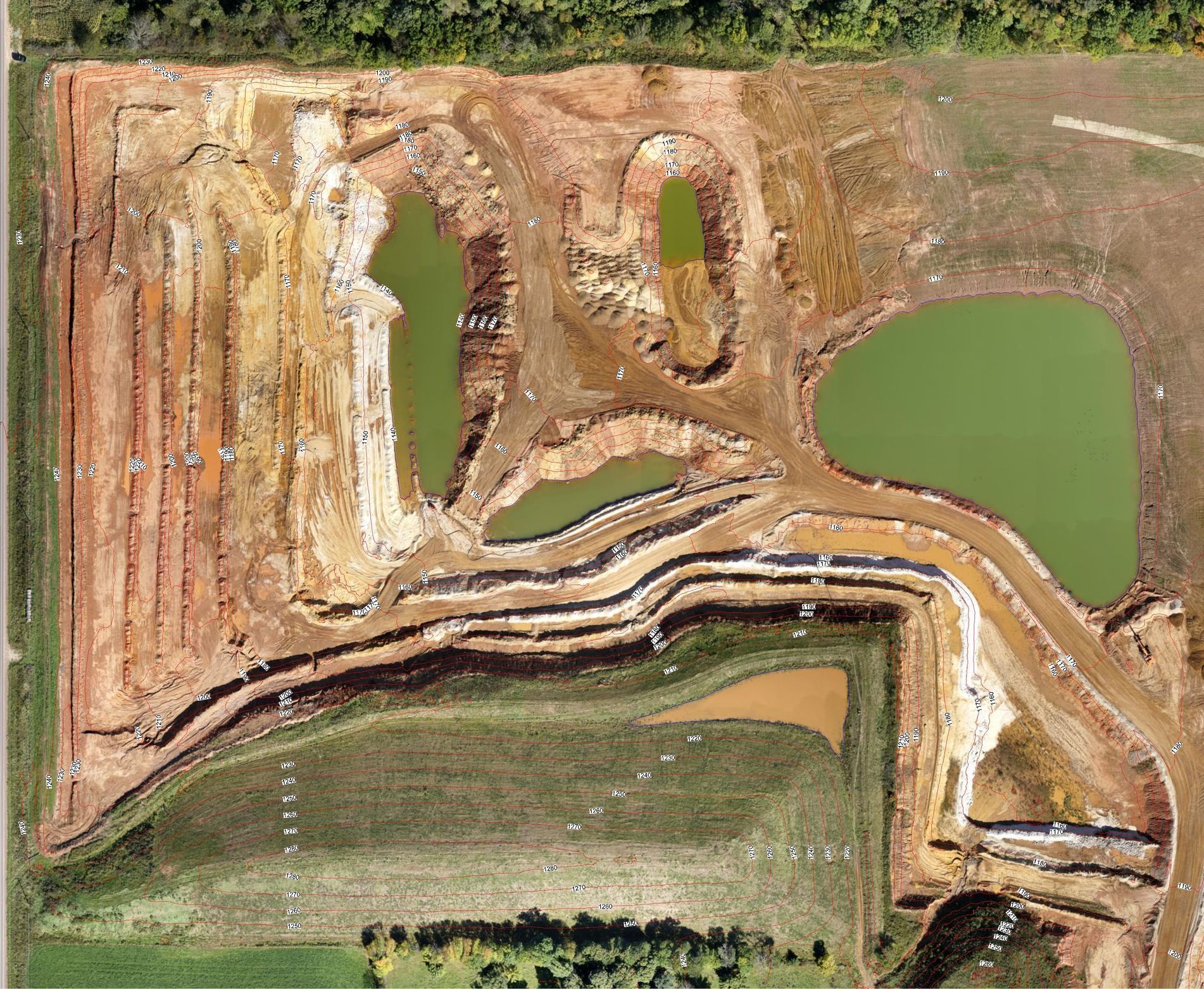
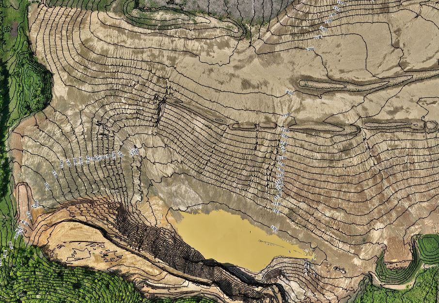
AERIAL MAPPING
GeoPro Mapping Solutions is a drone survey company in Chippewa Falls, WI, offering a full-service aerial mapping solution that is well above the industry standard. On every project, we set ground control points (GCP) with a survey-grade GPS so the project can be correctly and accurately scaled and georeferenced to real-world X,Y,Z coordinates. Every project is provided in the coordinate system as requested by the client. All image processing is performed in-house with specialized Structure from Motion (SfM) photogrammetry software. This allows us to have full control on the final deliverable.
General Procedures
- Acquire all legal items to perform your project
- Plan mission within your project boundaries
- Set ground control points (GCP's) with a survey-grade GPS around your project for accurate georeferencing and checks
- Perform autonomous flights to obtain imagery
- Post-process imagery in house to generate deliverables (no app-based product)
Deliverables
- Orthorectified (geometrically corrected for a uniform scale) mosaic image with world file
- Digital terrain model (DTM) bare earth
- Contours at 2’ and 10’ intervals in dwg. format
What to Look for in a Drone Mapping Professional
With all of the hype in the industry about what drones can offer it is very important that the service provider you chose is providing accurate data that you expect and they are claiming they can do. I have seen too many times that there are great salesmen and a lot of money put into marketing but the actual product doesn't live up to what they promised.
General Knowledge
- Surveyor
- Geospatial knowledge about coordinate systems and projectionns
- Equipment (quality of drone/ sensor)
- General knowledge of equipment and procedure
- Can set ground control points (GCP) to georeference data and create quality checks after the project is processed
- Post-processed the images in-house and not with an app based program. There is no human interaction with these so they can't add GCP's or clean the data.
- Geospatial reference the data. Put the project in a usable coordinate system in which your other data or designs are in
- Deliver products in formats that are easily usable by company or consultants
- Mapping background
- Knows what a DSM is
- Knows what a DTM is
- Volume calculation history
- Mine planning and analysis background
- MSHA certified
What Deliverables Can They Offer
- Orthorectified mosaic image (a distortion-free image of the project area)
- DSM
- DTM
- Contours in dwg. shp. formats
- Point clouds
- Professional final map products
- Corporate meetings
- Site planning meetings
- Permit acquisition/renewal
- Office or job trailer
Why We Are Different
GeoPro Mapping Solutions takes pride in taking the extra steps to provide dependable and accurate data that is uncommon in the drone mapping industry.
Main Areas That We Go Above and Beyond the Standard:
- Ground control points (GCP)
- Post-processing in-house
- Digital Surface Model (DSM) clean-up to remove unwanted artifacts such as buildings, vehicles, equipment, conveyor belts, contours on water, etc.
- Attention to detail
There is obviously a lot of hype in the Surveying and Engineering community about drones and what they can do. With all the hype comes a lot of rogue drone service providers that offer services and data that is subpar with little knowledge of this to the client. With our Land Surveying education, surveying work experience and mining work experience over the past 18 years we know what the industries need for quality data. The workflows we use on each mapping flight take longer than the typical drone service provider because we take the time to set ground control and checkpoints across the mapping area with a survey-grade RTK GPS to georeference the data. This georeferenced data is tied to real world X,Y,Z coordinate values and is placed in a coordinate system that is currently used by the client in their CAD program. The final deliverables are basically a drag and drop into their CAD software for analysis and calculations.
The ground control is important for accurate, scalable final data but a post-processing software also needs to be used to accurately identify the ground control and provide DSM cleanup. All of our flight images are post-processed in house with a specialized Structure from Motion (SfM) photogrammetry software. We are not using a third party contracted system or an online app-based solution. With this, we have full control over the post-processing steps, DSM, DTM, and orthorectified final mosaic image. Adding ground control to the processing allows us to place the data into real-world coordinate values, remove image distortion and scale the project accordingly. The next step is to clean up the DSM and provide the client with DTM bare earth contours. This step is very uncommon in the industry because it is time-consuming and a lot of drone service providers are using contracted systems or app-based processing software which does not offer any human interaction (at this point). This step removes any unwanted artifacts, which is a result of SfM photogrammetry, such as buildings, vehicles, equipment, conveyor belts, contours on water, etc. This final DTM can be immediately used by the client for analysis and calculations without needing to “clean up” the data or factor for these artifacts.

Phone: (715) 492-0504